Urban Planning
Artifacts of process
Art@Bartram's
MAPS, ILLUSTRATIONS, LAYOUT, & PRINT OVERSIGHT
CLIENT: LINDY INSTITUTE FOR URBAN INNOVATION
2015
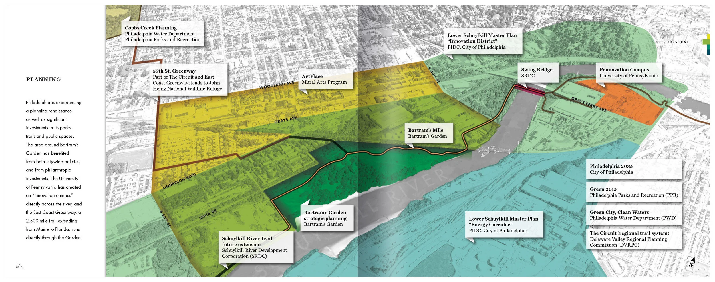
Art@ Bartram's is an action plan for the implementation of a public art program to increase the recognition of Bartram's Garden. This extraordinary oasis in Philadelphia has the unique capacity to connect the western banks of the lower Schuylkill River to the urban core. The report layers vibrant imagery with energetic colors over text on a stiff grid. Timelines highlight the three historic eras that have shaped Bartram's Garden. Aerial diagrams using base photography from Landsat 7 satellite imagery provide a context for the four art-making principles.
Civic Infrastructure Report Series
ILLUSTRATIONS, LAYOUT, & PRINT OVERSIGHT
CLIENT: PENNPRAXIS
2017 & 2018
This two-part series proposes a change in mindset that we not only consider “hard” elements like parks, libraries, and public spaces as part of our shared civic assets, but also “soft” elements such as governance, community traditions, and partnerships; together forming a connected “ecosystem” of civic infrastructure. Practitioners and organizations who are involved in civic asset redevelopment are called on to think of their projects working across three scales: site, system, and policy.
The reports are intended mainly for reading on screen, so they’re designed as single pages that scroll, with minimal top and bottom margins, large body text, and bright, in-line pull quotes, for engaging, seamless reading.
Green2015: An Action Plan for the First 500 Acres
MAPS, ILLUSTRATIONS, LAYOUT, PRINT OVERSIGHT, & PRESENTATION DESIGN
CLIENT: PENNPRAXIS
2010
Greenworks Philadelphia laid out a path for Philadelphia to be the greenest city in the country by 2035. One of its targets was to provide park and recreation resources within a 10-minute walk of 75 percent of residents. Given that 200,000 Philadelphians do not have equitable access to parks and open space, that target would require the acquisition or conversion of almost 11,000 acres of land. As a benchmark, Greenworks set to create 500 acres of new open space by 2015, and Green2015 is the result of that goal. Bright, friendly illustrations play with the idea of organic growth and offset data-driven maps, while the motif of tree rings measures progress and time.
"Andee has a remarkable ability to fluidly cross disciplinary boundaries. She has an exemplary dedication to craft and an unflappable ability to communicate complex ideas."
—Harris Steinberg, former Executive Director of PennPraxis (currently Executive Director of Drexel University's Lindy Institute for Urban Innovation)
The New Fairmount Park
maps, illustrations & layout of INTERACTIVE PDF
CLIENT: PENNPRAXIS
2014
East and West Fairmount Park were never designed to be a park, but rather assembled as a working landscape to protect Philadelphians' drinking water—becoming the country's first municipally protected watershed. Not planned as a singular landscape, both suffer from a lack of physical, programmatic and community cohesion. Institutions struggle in isolation, roadways fragment the landscape, and barriers limit access—even from one side to the other. In 2013, more than 1,000 Philadelphians began work on an achievable improvement plan, and the artifact I created tells the story of this process.
In the end, it's still all about the water. The creeksheds that feed the Schuylkill River organize the short- and long-term visions for the park. They also define actions that leverage existing planning momentum and make the most practical impact for nearby neighborhoods. Given the project's non-linear narrative and need to reach a wide audience, the report is an interactive PDF so that, on screen, readers can easily access the sections of the report that matter most to them.
More Park, Less Way
ILLUSTRATIONS, LAYOUT, PRINT OVERSIGHT, & POSTER DESIGN
CLIENT: PENNPRAXIS
2013
For Philadelphia, The Benjamin Franklin Parkway has something of a binary existence. A world-class cultural destination hosting millions of tourists each year, it is also the backyard for 70,000 Philadelphians. Anchored by the Philadelphia Museum of Art and City Hall, this verdant barbell struggles to serve the myriad communities on the street grid that it divides.
Unlike other planning documents written about the Parkway, this plan focuses on four interrelated actions—achievable within three years—to make this iconic landscape a more viable and vibrant destination. Colorful, rich photographs populated with life showcase its grand character. A bold, "let's-get-to-it" layout communicates the need to hit the ground running with the plan's actions, and fun character scenarios balance out dense blocks of text. A folding poster served as a summary, for wider distribution.


